Introduction to Drone Mapping
This course will allow you to formulate a strong understanding around the core functions within Pix4D photogrammetry software. It is aimed at professionals who will benefit from the use of a photogrammetry capability, whilst typically deploying unmanned aerial vehicles for their day to day survey works. Pix4D & AgiSoft Metashape are highly capable drone mapping platform that has many in-depth functions.
• This course does not need any prior drone related experience. Anyone can take it up!
What Will You Learn?
Our course offers students the opportunity to develop their knowledge of:
• Data Capture process including the use of capture apps.
• Environmental factors affecting data capture.
• Creation of georeferenced maps.
• Creation of 3D models.
• Phraseology and meaning of Pix4D & AgiSoft Metashape processes.
Course Details
Number of Process man: 6
Training location: Classroom; client’s place of business. A location for the process training will be selected in the greater real area.
Training date: To be determined upon mutual agreement with the client and M.A.S. Scheduling of process training is subject to you.
Lesson 1: Camera
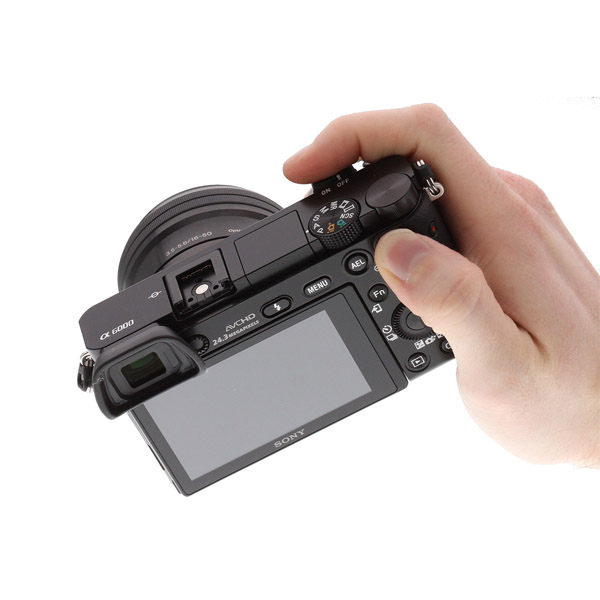
• Basic types of digital cameras used in UAV’s
• How a CCD and CMOS sensor work
• Bayer Filter basics
• Pixel size and signal to noise
• Electromagnetic spectrum
• Atmosphere interactions / scattering
• IFOV – Instantaneous Field of View
• Types of resolution
- Spatial (GSD)
- Spectral (multispectral, hyperspectral)
- Radiometric (bit depth / dynamic range)
- Temporal
• Types of sensors used in unmanned aerial survey
- Passive Vs Active
• Errors caused by platform (UAV) movement
- Pitch
- Roll
- Yaw
- Altitude
- Velocity
• Types of UAV airframes and how they relate to platform errors
• Geometric errors caused by sensor
- Rolling shutter effects
- Lens distortion effects
Lesson 2: UAV surveying and basic principles
• What photogrammetry is?
• Surveying and UAV Photogrammetry techniques.
• Learn about surveying accuracy and how you can achieve the best possible accuracy.
• How to design Ground Control Points (GCPs) distribution.
• Choose the best drones for aerial surveying.
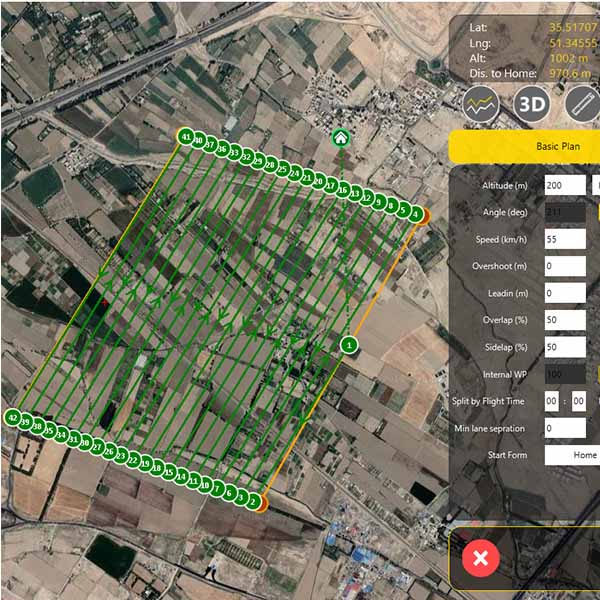
• Learn about flight planning techniques and basics.
• How to plan flights for different cases, e.g. urban area surveying, Corridor mapping, agriculture surveying and spraying etc...
• Learn how to use kml/excel files and gps tagging apps to plan your flights
• Internalize all practical aspects of flight execution - marking boundary points, choosing best take off points, adjusting flight parameters, image quality and coverage check, continuing flights mid-way in a mission.
• Identify the technical and environmental limitations affecting the use of photogrammetry data capture.

Lesson 3: Introduction to data processing
• How to create a data set of images with reliable geo-referencing.
• Block adjustment and creating initial point cloud.
• Understand where to use manual tie points and why.
• Generate Dense Cloud, Mesh and 3D model.
• Create DSM and Orthomosaic.
• Contour line, profile, sections and volume calculation.
• Understand some of the file outputs that can be exported to offer data platforms.
• Be able to operate Pix4D capture app.
• Introduction to cartography rules and techbiques
• Mono-plotting with Orthomosaic and DEM
• Select double adjacent images and import camera parameters to digital drawing software
• Creating 3D model in stereo vision